The 138-mile-long Mojave Road, or rather the 30-odd miles of it that I’ve so far experienced, has left me with two strong impressions.
 Firstly, the road didn’t just happen by chance. It’s an essential link in a “connect-the-dots” line from the San Bernardino mountains all the way to the Colorado River. The dots are water sources. In this sere locale, any travel of any sort mandated water stops along the way. Early Indians seasonally migrated, and later miners and ranchers traveled, along the route. Water was king, and the springs and wells defined the pathways.
 Secondly, as with many back-road explorations I’ve undertaken during the last 50 years or so, probably 95% of Mojave Road can be negotiated by a high-clearance 2WD or AWD. But that tiny little 5% consists of sandy uphills, rocky canyons, washed-out side-hills, and the like. In these places, only the “serious” 4WD rigs have a chance of passing through. Consequently, the Road is such that you can easily explore many sections of it without special equipment or skills. However, to travel on it continuously from any arbitrary point to another, you will need good gear and good skills. Attempting passage without both of these ingredients is a sure recipe for bad-stuck and/or breakdown.
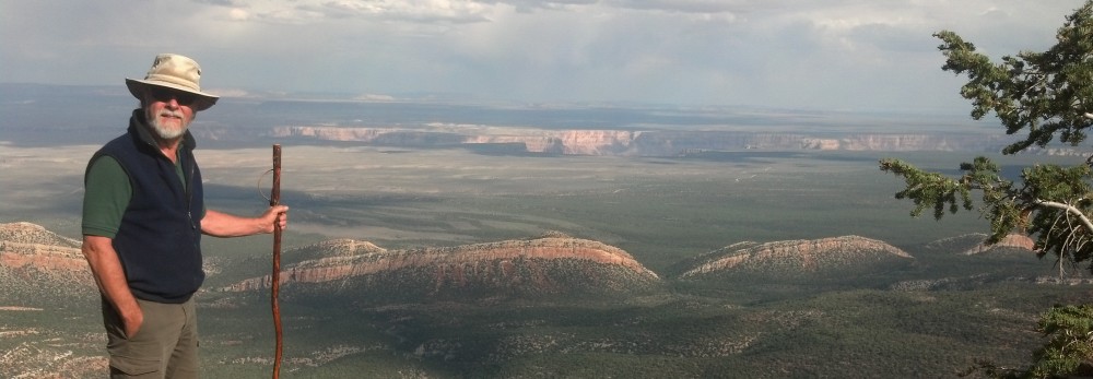
Today, we set out to explore and enjoy yet another dimension of the Mojave Preserve, specifically the roads and environs of Government Holes and Rock Springs water holes.
Government Holes
– – – was actually a single hole (well) and one of the most reliable in the area.
It was also home to some of the more outrageous behavior in Western history, right up there with “dime novel” stuff but totally true. Murders, thievery and all sorts of excitement.
 Today, the well is serviced by a cantankerous old windmill, in near-conflict with a big cottonwood tree. The clanking, creaking water pump doesn’t seem to be an issue with local hawks who’ve built their nest just a few feet away from the wind-swinging tail of the windmill.
 Just down the hill a circular cattle trough makes for many snapshots by passers-by. Cattle are still being raised on the land, and although considerably desert-abused, all the local corrals and cattle-handling “furniture” are in serviceable condition.
Rock Springs
 Yet another striking, delightful departure from the “normal” spread of the surrounding desert, Rock Springs flows year-round from a large rocky outcropping. Although more sporadic in flow than the nearby Government Holes, it was nonetheless an important historical waypoint.
The feeling of coming upon this scene brings up dream/thoughts of the early travelers. Walking up the sandy mouth toward the spring produced dark-sand moisture flags with each heel scuff. I can hardly imagine the joy of arriving at water after 20-30 miles of hard Mojave travel, on foot or by wagon.
Of course, the traditional cottonwood marks the spring proper, and the woody debris scattered over twelve feet up the trunk of the tree is quiet testimony to the volume of water that passes by during the rainy seasons.
 The scrawny, towering, desiccated collection of twigs makes it hard to imagine a kelly-green profusion of serrated leaves fluttering in the summer breeze of just a few months ago. But the still-running trickle of a stream, the thin warm pond, and the proliferation of algae on the sheltering rocks, all verify the constant presence of life-giving water.

The spring is in a designated wilderness area, and we’d walked a quarter-mile to visit it. Ralph waited patiently for us, outside the wilderness boundary at the mouth of Rock Springs Canyon.
After leaving the Mojave Road watering holes, we almost decided to head back for camp via the “good” roads. But adventure overcomes conservatism, and we elected another “long cut”.
This time, we traveled only a few miles of Mojave Road, and then headed straight into the back country. We had about two hours of daylight remaining, and 20 miles of rugged, possibly washed-out or gated-closed, unknown and only partially mapped roads to cover. Snug, but should be possible, we thought.
Well, we were right, but still experienced a few anxious moments.
The most memorable one was actually just out of Rock Springs, a nasty hill made considerably nastier by horrendous assaults of water. The only thing recognizable about this “road” was that there was no vegetation growing on it. Otherwise, it was gouged out, rutted deep, off camber and filled with chair-sized rocks.
For the first time ever, Ralph was actually stopped and/or stuck, not once but several times. And this happened in 4WD compound-low with the Detroit Truetrak locking differential – – in short, despite all the advantages. I had to rock him back and forth, swing the front tires side-to-side for extra purchase, and several times back a few feet to inch over slightly to one side or another. One tire on the front or back was constantly hanging in the air. It was HARD. It was only by patient, gentle urging that I managed to get him up over the top, and I confess I was never sure it was actually going to happen.
Karin was, fortunately, much more impressed than frightened by this little episode. She commented after the climb that she’d always heard me talk about years of desert experience, but she half-thought it was pretty much that – – just talk. “Well, today you proved it” was her assessment.
I’ll tell you something folks: There’s praise, then there’s high-praise, and then – – – there’s high-praise from your loved one. That last one is the best there is. I spent the rest of the drive pretty much floating with pride. Ralph was happy too.
